
Geospatial Analytics
0
0
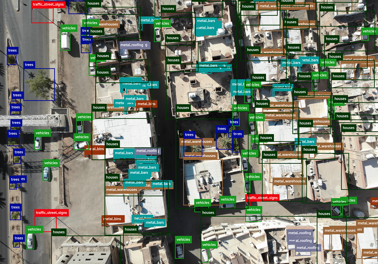
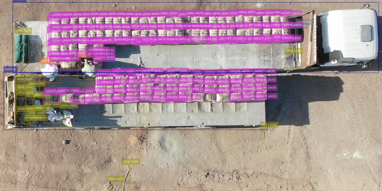
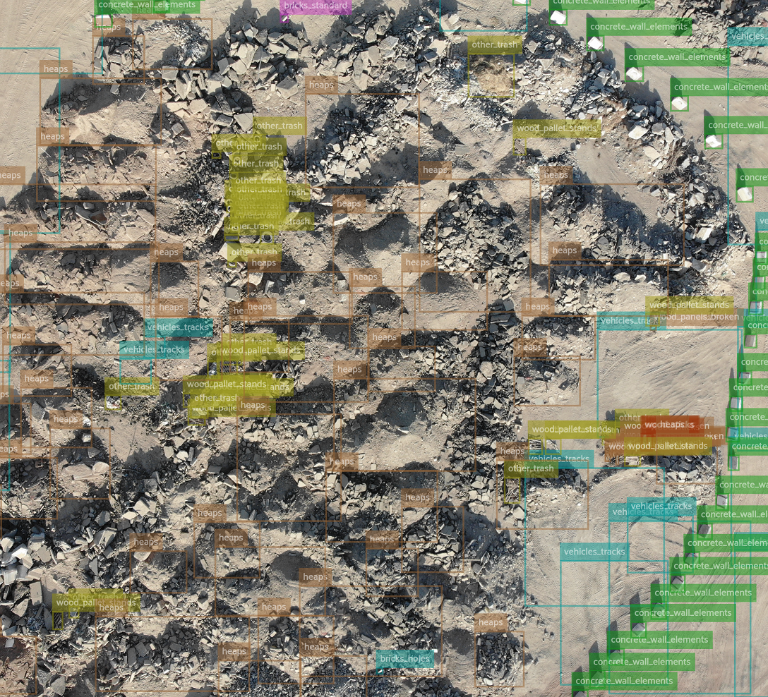
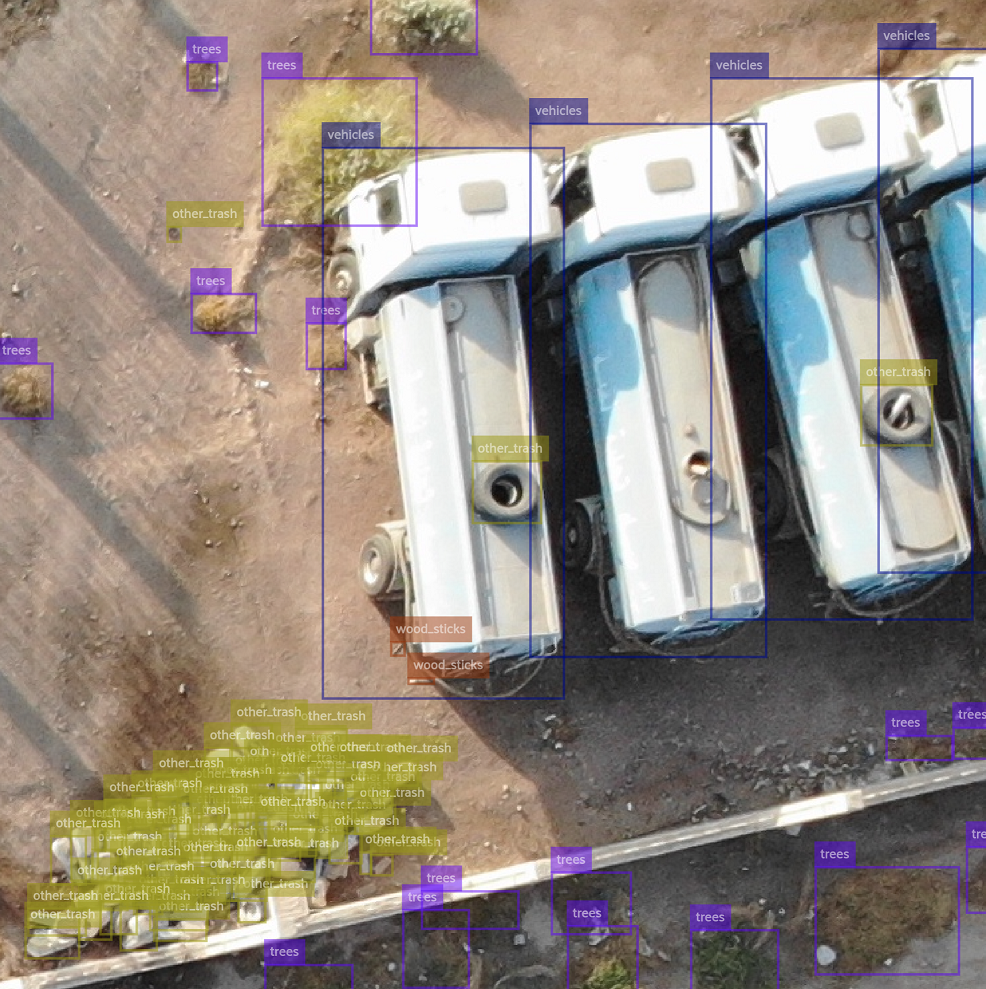
A software to automatically analyze drone and satellite images, extract insights and streamline them in a consumable and user-friendly form such as Geographic information system (GIS) or BI dashboard/report. Geospatial Analytics enables staff members to utilize multiple available analytical models, such as trash detection, construction debris, trees/plants, cars, houses, people, solar panels, swimming pools, and other.
It allows users to automate detection, recognition and counting of various objectы that typically require huge manual effort e.g. cars, boats, trees, people, etc. Employees can automate the inspection of the site for compliance, manage border control activities and detection of illegal intrusion, detect object and materials for inventory management, iden...
Ask anything of Geospatial Analytics with Workflos AI Assistant
https://aisuperior.com/products/geospatial-analytics/
Apolo
Squeak squeak, I'm a cute squirrel working for Workflos and selling software.
I have extensive knowledge of our software products and am committed to
providing excellent customer service.
What are the pros and cons of the current application?
How are users evaluating the current application?
How secure is the current application?
 Sign up for free
Media
SSO Free Forever
Manage Google Drive, Mailchimp, Dropbox Business, Microsoft PowerPoint, QuickBooks Desktop Enterprise, Canva, Zoho One, DocuSign, Salesforce Sales Cloud Suite, Adobe Photoshop with SSO