Pandell GIS
0
0
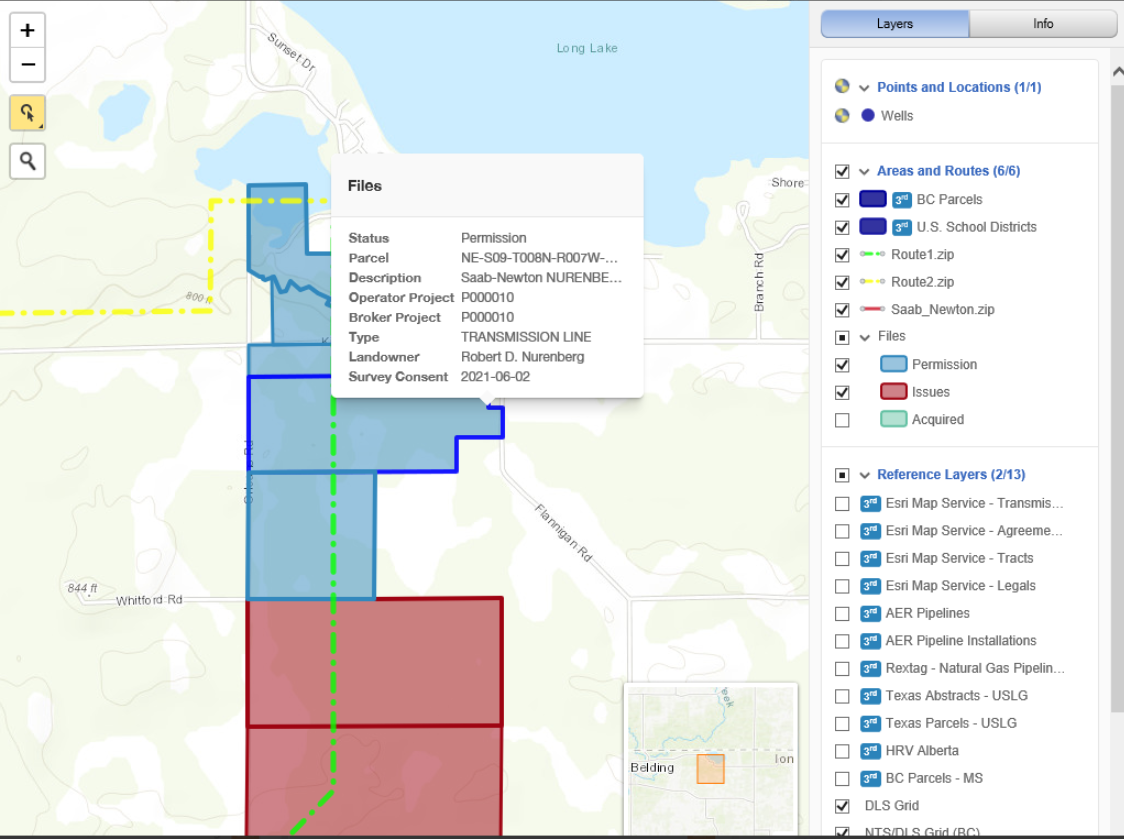
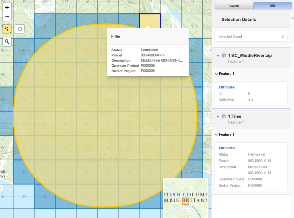
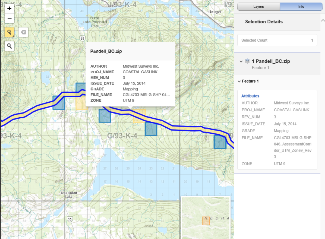
Pandell GIS is a land mapping software that helps businesses create and maintain spatial data for various projects including utilities, upstream and midstream oil and gas and renewables. The platform enables managers to capture and record agreement details and track the status of land rights on a unified interface.
Key features include auto-mapper, parcel tools, master tract loader, GIS analyzer, lease dissection, GIS-enabled dashboards and live project status maps. Additionally, Pandell GIS lets stakeholders integrate the system with several applications including Pandell LandWorks and ArcGIS.
Ask anything of Pandell GIS with Workflos AI Assistant
https://www.pandell.com/energy/pandellgis/
Apolo
Squeak squeak, I'm a cute squirrel working for Workflos and selling software.
I have extensive knowledge of our software products and am committed to
providing excellent customer service.
What are the pros and cons of the current application?
How are users evaluating the current application?
How secure is the current application?
 Sign up for free
Media
SSO Free Forever
Manage Google Drive, Mailchimp, Dropbox Business, Microsoft PowerPoint, QuickBooks Desktop Enterprise, Canva, Zoho One, DocuSign, Salesforce Sales Cloud Suite, Adobe Photoshop with SSO